
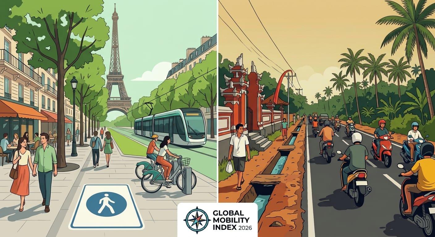
Recent mobility research evaluating 75 leading international destinations highlights a sharp divide between compact, transit-first metropolises and sprawling, vehicle-dependent destinations. Cities were scored on a 100-point scale across six core infrastructure pillars:
Public transport stop density (25%)
Pedestrian walkability (20%)
Dedicated cycling infrastructure (15%)
Public transit ticket affordability (15%)
Airport-to-city-centre rail and bus connections (15%)
Local taxi and rideshare costs (10%)
Global Rank | City & Country | Car-Free Score (/100) | Regional Standing | Key Mobility Advantage or Challenge |
#1 | Paris, France | 72.06 | #1 in Europe | ~22 transit stops per sq km; direct RER airport rail |
#2 | Helsinki, Finland | 70.84 | #2 in Europe | Integrated trams, ferries, and high-speed airport rail |
#3 | Warsaw, Poland | 70.68 | #3 in Europe | Budget-friendly fares, dense tramways, expanding metro |
#10 | Seoul, South Korea | 65.09 | #1 in Asia-Pacific | Ultra-high-tech subway network and low fare caps |
#11 (tie) | Taipei, Taiwan | 63.99 | #2 in Asia-Pacific | Seamless MRT, YouBike sharing, and walkability |
#11 (tie) | Tokyo, Japan | 63.95 | #3 in Asia-Pacific | Punctual rail network linking every neighborhood |
#12 | Toronto, Canada | 64.13 | #1 in North America | Extensive streetcar grid and UP Express airport link |
#15 | Hong Kong | 63.46 | #4 in Asia-Pacific | World-famous MTR, Star Ferry, and pedestrian skybridges |
#19 | Montreal, Canada | 61.92 | #2 in North America | Protected BIXI bike network and underground metro |
#20 | San Francisco, USA | 61.78 | #1 in United States | Compact 7x7 footprint with BART, Muni, and cable cars |
#21 | Singapore | 61.21 | #5 in Asia-Pacific | Integrated MRT/bus transfers and covered walkways |
#28 | Vancouver, Canada | 58.02 | #4 in North America | Automated SkyTrain from YVR airport and seawall paths |
#35 | Washington, D.C., USA | 55.67 | #2 in United States | Clean Metro rail and Capital Bikeshare network |
#38 | New York City, USA | 54.98 | #3 in United States | 24/7 subway operations offset by higher fare/taxi costs |
#68 | Hanoi, Vietnam | 42.64 | Challenging (Asia) | Heavy motorbike reliance; nascent metro expansion |
#70 | Ho Chi Minh City, Vietnam | 40.08 | Challenging (Asia) | Limited pedestrian crossings and high traffic congestion |
#71 | Honolulu, USA | 38.99 | 3rd Hardest in US | Island geography requires cars for outer-coast exploration |
#72 | Orlando, USA | 36.47 | Hardest in US | Theme-park sprawl built around multi-lane highways |
#73 | Las Vegas, USA | 36.56 | 2nd Hardest in US | High-heat walking distances and limited rail outside the Strip |
#74 | Bali (Denpasar), Indonesia | 34.08 | 2nd Hardest Globally | Minimal sidewalks, scarce public transit, scooter dependency |
Europe Dominates the World’s Best Cities for Car-Free Travel
Europe accounts for seven of the world's top ten destinations for car-free exploration, led by Paris, Helsinki, and Warsaw. Centuries-old urban layouts designed before the invention of the automobile, combined with aggressive modern investments in low-emission zones and bicycle superhighways, make European capitals effortless to navigate on foot or by rail.
1. Paris, France (72.06 / 100)
Paris claims the #1 global ranking thanks to sheer transit saturation and pedestrian-first urban planning. Within its core districts, travellers are rarely more than a three-minute walk from a station, boasting roughly 22 public transport stops per square kilometre.
Airport Connectivity: Direct RER B trains connect Charles de Gaulle Airport (CDG) straight to central hubs like Châtelet–Les Halles and Gare du Nord in roughly 35 minutes.
Slowmad & Traveller Advantage: With the city's expansive network of protected bike lanes (pistes cyclables) and pedestrianized Seine riverbanks, remote workers can easily commute between coworking cafes in Le Marais, Bastille, and Saint-Germain-des-Prés without ever hailing a cab.
2. Helsinki, Finland (70.84 / 100)
Helsinki secures second place globally by turning multi-modal transport into a unified digital experience. The city's HSL transit system integrates trams, buses, commuter trains, the metro, and even municipal ferries to Suomenlinna sea fortress under a single mobile ticket. Compact, safe, and exceptionally clean, Helsinki rewards travellers who prefer walking and cycling along Baltic waterfront paths.
3. Warsaw, Poland (70.68 / 100)
Warsaw proves that world-class urban mobility doesn't require Western European prices. Ranking third worldwide, Poland's capital combines wide, rebuilt post-war boulevards with an ultra-reliable tram network, a rapidly expanding automated metro system, and some of the lowest single-ride ticket costs in the European Union. For budget-conscious digital nomads seeking high-speed infrastructure without high rent, Warsaw stands out as a premier European base.
Asia-Pacific: A Tale of Two Extremes for Car-Free Travellers
Asia-Pacific houses both the world's most advanced hyper-efficient transit megacities—led by Seoul, Taipei, and Tokyo—and some of the most challenging destinations for pedestrians, such as Bali and Ho Chi Minh City. Understanding this contrast is vital before booking a multi-month stay in the region.
The Transit Powerhouses: Seoul, Taipei, and Tokyo
Seoul, South Korea (65.09 / 100 — #10 Globally): Seoul leads the Asia-Pacific region with one of the most punctual, cleanly designed, and technologically integrated subway networks on Earth. Equipped with heated seats, platform screen doors, free station Wi-Fi, and seamless T-money tap cards that work across subways, buses, and convenience stores, Seoul makes navigating a metropolis of nearly 10 million people intuitive even for first-time visitors.
Taipei, Taiwan (63.99 / 100): Taipei pairs its spotless MRT rail network with the ubiquitous YouBike public bicycle program, allowing travellers to dock and undock bikes at thousands of stations across the city for pennies per half hour.
Tokyo, Japan (63.95 / 100): Tokyo's interconnected web of JR lines, Tokyo Metro, and Toei subways moves millions of commuters with second-by-second accuracy. While station complexes like Shinjuku require digital navigation apps to master, you never need a car to reach any corner of the Greater Tokyo area.
Hong Kong (63.46 / 100) & Singapore (61.21 / 100): Rounding out the regional top five, both cities feature world-class contactless payment gates (allowing travellers to tap a standard foreign credit card or mobile wallet directly at turnstiles) alongside extensive covered walkways designed for tropical climates.
Why Southeast Asian Hotspots Score Lower for Car-Free Mobility
Despite ranking among the fastest-growing digital nomad hubs in 2026, several Southeast Asian favourites rank near the bottom of car-free indexes:
Bali (Denpasar), Indonesia (34.08 / 100 — #74 Globally): Ranking as the second-hardest destination worldwide to explore without personal transport, Bali lacks municipal rail infrastructure, features narrow or non-existent sidewalks in many areas, and offers minimal protected cycling lanes. Most visitors rely heavily on rented scooters or app-based motorbike taxis (Grab and Gojek) to move between Canggu, Ubud, and Uluwatu.
Ho Chi Minh City (40.08 / 100) & Hanoi (42.64 / 100), Vietnam: While Vietnam's major cities offer incredible affordability and vibrant street life, heavy motorbike traffic, sidewalk parking, and still-developing urban rail systems make walking long distances or relying solely on buses challenging for newcomers.
North America: Canada Outperforms the United States in Urban Mobility
Canadian cities significantly outperform US destinations in car-free travel readiness, with Toronto, Montreal, and Vancouver all ranking higher than New York City, Washington, D.C., and Los Angeles.
Why Canada Leads North America
Toronto (64.13 / 100 — #12 Globally): Toronto claims the top spot in North America. Its iconic red streetcars, extensive bus grid, and subway lines integrate smoothly with the UP Express, a dedicated rail link that whisks travellers from Toronto Pearson International Airport (YYZ) to downtown Union Station in just 25 minutes.
Montreal (61.92 / 100 — #19 Globally): Montreal narrowly edges out San Francisco thanks to its deep-level rubber-tired Metro, North America's most extensive network of four-season protected bike lanes, and the RÉSO—a 33-kilometre underground pedestrian network connecting offices, transit hubs, and shopping centers during harsh Canadian winters.
Vancouver (58.02 / 100): Vancouver's driverless SkyTrain connects Vancouver International Airport (YVR) directly to the waterfront downtown core, where pedestrian seawalls and passenger ferries (SeaBus) eliminate the need for a vehicle.
The US Divide: Compact Transit Hubs vs. Car-Centric Sprawl
In the United States, car-free viability depends almost entirely on whether a city was built before or after the interstate highway era:
Best US Cities Without a Car: San Francisco (61.78 / 100) leads all US destinations, benefiting from its compact 49-square-mile geography, BART airport rail, Muni light rail, and high walkability. Washington, D.C. (55.67) takes second place with its clean, commuter-friendly Metro and flat, bikeable National Mall corridor, while New York City (54.98) ranks third—boasting unmatched 24/7 subway coverage, though slightly tempered in scoring by higher single-ride fares and steep airport taxi rates.
Hardest US Cities Without a Car: At the opposite end, Orlando (36.47 / 100) ranks as the single hardest US city to navigate without a vehicle, followed closely by Las Vegas (36.56) and Honolulu (38.99). In Orlando and Las Vegas, multi-lane highways, extreme summer temperatures, and vast distances between resorts and neighborhoods make renting a car or budgeting heavily for rideshares almost mandatory.
Why Seamless Mobile Data Is the Secret to Car-Free Travel
Navigating an unfamiliar transit system without a car requires real-time information at every step. Unlike driving a rental car with built-in GPS, car-free travel relies on live multimodal coordination:
Live Train & Bus Routing: Apps like Citymapper, Google Maps, and Naver Map (essential in South Korea) require constant mobile data to alert you to platform changes, express vs. local train splits, and last-train departure times.
Contactless Digital Ticketing: Cities from London and Singapore to New York and Toronto increasingly rely on mobile transit apps, QR-code bus passes, and instant Apple Pay/Google Pay tap-to-ride reloads.
Micro-Mobility Unlocking: Renting a Lime scooter in Paris, a YouBike in Taipei, or a BIXI bike in Montreal requires scanning a QR code with an active cellular connection.
On-Demand Rideshare Backups: Even in top-scoring transit cities, late-night arrivals or sudden downpours may call for Uber, Bolt, Grab, or Kakao T—all of which require stable data for driver messaging and live pin-drop tracking.
Relying on patchy café Wi-Fi or paying steep daily international roaming fees from a home carrier creates unnecessary friction the moment you step off the plane. Setting up a digital travel eSIM before departure ensures your phone connects to local 4G/5G networks the second your aircraft touches down.
If you are planning an upcoming multi-country trip or scouting your next remote-work base, you can explore affordable, instant-activation data plans directly at CloudOn or browse destination-specific eSIM packages in the CloudOn Store. Having reliable connectivity from airport arrival to your final train connection lets you focus on exploring neighborhoods rather than hunting for SIM kiosks.
How to Plan a Car-Free City Break or Slowmad Stay: 6 Actionable Steps
Even in cities that score moderately on global transit indexes, smart pre-trip planning can eliminate the need for a rental car. Follow this checklist before booking your next itinerary:
1. Audit Airport-to-City-Centre Transit First
Before booking flights or accommodation, check whether your destination offers a dedicated airport express train, metro line, or coach bus. Knowing whether you can take a $5 train (like Madrid's Metro Line 8 or Toronto's UP Express) versus a $70 taxi ride immediately shapes your arrival budget and stress level.
2. Book Accommodation Within a 5-Minute Walk of a Rail Hub
In transit-rich cities, proximity to a major subway or tram interchange matters far more than being right next to a single tourist landmark. Staying near a multi-line station gives you direct, transfer-free access to every neighborhood, coworking space, and regional day-trip train station.
3. Compare Multi-Day Transit Passes Against Contactless Tap-to-Ride
Many cities offer 3-day, 7-day, or monthly commuter cards (such as Tokyo's 72-hour Subway Ticket or Paris's Navigo weekly pass) that pay for themselves after just three or four rides per day. Conversely, cities like London and Sydney enforce automatic daily and weekly contactless fare caps, meaning you can simply tap your phone or credit card without pre-buying a paper pass.
4. Cluster Your Itinerary by Neighbourhood
Avoid zigzagging across a metropolis multiple times a day. Group museums, cafes, local markets, and dinner spots within walkable micro-neighborhoods—such as exploring Shibuya and Harajuku together in Tokyo, or pairing Montmartre with Canal Saint-Martin in Paris.
5. Download Offline Maps and Local Transit Apps Before Takeoff
Before boarding your flight, download offline city maps in Google Maps alongside the city's official transit app. Pair these offline backups with a pre-installed eSIM from the CloudOn Store so you have both offline fail-safes and instant live schedules upon landing.
6. Check Last-Mile Options for Day Trips
Central districts in cities like Seoul, Warsaw, and San Francisco are effortless without a car, but national parks, coastal trails, or rural vineyards on the outskirts may have limited bus frequencies. Check weekend shuttle timetables in advance or book a single-day guided transfer only for those outer-ring excursions.
Frequently Asked Questions (AEO Quick Answers)
What is the best city in the world to visit without a car?
Paris, France is ranked as the #1 city in the world to explore without a car, scoring 72.06 out of 100. It offers roughly 22 public transport stops per square kilometre, extensive pedestrian zones, protected bike lanes, and direct rail links to Charles de Gaulle Airport.
What is the easiest US city to explore without a car?
San Francisco, California is the easiest US city to navigate without a car, scoring 61.78 out of 100 (#20 globally). Its compact 7-by-7-mile layout, high walkability, and interconnected BART, Muni, and streetcar systems outrank Washington, D.C. (55.67) and New York City (54.98).
Which major tourist destinations are the hardest to explore without a car?
Among 75 major global destinations analyzed, Bali (Denpasar), Indonesia (34.08/100) and Orlando, USA (36.47/100) rank among the most challenging to navigate without personal transport due to limited public rail networks, sprawling layouts, and low pedestrian infrastructure scores.
Which Canadian city has the best public transportation for travellers?
Toronto leads both Canada and all of North America for car-free travel with a score of 64.13 out of 100 (#12 globally), closely followed by Montreal (61.92) and Vancouver (58.02).
¿Listo para conseguir una eSIM?
Explora planes para más de 200 países. Compra en minutos, instala en segundos.